Utter_Kaos
Active member
What app do you use for tracking your trip or knowing where you are on the mountain ?


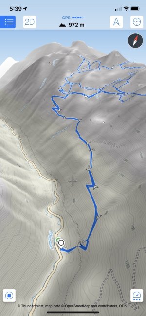
Locus Maps. European, but free and does what I need.What app do you use for tracking your trip or knowing where you are on the mountain ?
A trusty Garmin 62S
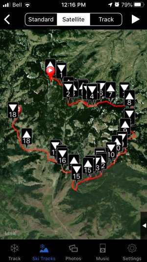
Skitracks, there’s a free version or a paid version. It’s worth the money. Tracks all your speed data, gps offline, integrates photos with locations during the day, set waypoints, and share your tracks.