- Thread starter
- #41
BRP QSC
Active VIP Member
Ok im in for it
RP
RP


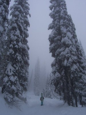
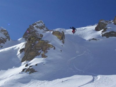
there is that way in and there is also a way in from beavermines lake I think it is grizzly creek that will take you back to waterton as well!! I must say the area by beavermines lake is awesome and rarely sees any traffic definately a must do if you are in that area. From beavermines lake you can see the bald mountain i was talking about towards the bc side of things it makes me wanna start maiking my own trail into there just to clib a couple of the mini chutes:d
yea middle koots pass hooks up with flat head rd if i remember correctly?? This one is if your at west castle and you hit the bridge/river crossing in the first big clearing, everyone goes right. If you go left, it is a maze back in there but basically stay on the main trail, lol or what you think is the main trail. There are 3 or 4 creek crossings? on the last one go left, it will look like a right hand turn, but there is a hiddien trail in behind, sorta overgrown for the first 100 ft.
Hey Sledqueen, the trail your asking about does not continue to Waterton. It dead ends in another bowl. It's very tuff to get into, and not used much anymore. 20 years ago was a lot easier. Very very few people know about that trail. As for all these other areas that Jaradszakacs is talking about, we hit most of them every year (we're just good at hiding our tracks). There is a way around the waterfall going up to rainy ridge from the B.C side. You can go up to the left of it, and then sidehill across. It works quite well going up, but can be hard to stop on the way down. Anyways, I know the area very well, just don't know all the names. I've never used a map, just sled there a lot.
Hey Sledqueen, the trail your asking about does not continue to Waterton. It dead ends in another bowl. It's very tuff to get into, and not used much anymore. 20 years ago was a lot easier. Very very few people know about that trail. As for all these other areas that Jaradszakacs is talking about, we hit most of them every year (we're just good at hiding our tracks). There is a way around the waterfall going up to rainy ridge from the B.C side. You can go up to the left of it, and then sidehill across. It works quite well going up, but can be hard to stop on the way down. Anyways, I know the area very well, just don't know all the names. I've never used a map, just sled there a lot.
no worries I should be riding either friday-sundays or saturdays to monday not sure yet on the new schedule
You come all the way from Cranbrook to ride crowsnest?
Good on you for sharing your secret spots. I understand both sides of the agruement of hidden/public spots. A part of me thinks there is nothing worse then getting your play area poached on a beautiful, untouched day, but then again it's not "anybody's" area.
I was going to go dualsport down there and do the loop to find more sledding areas southwest of Castle. Actually, a two part trip. A) find more locations, and B) find more slopes to ride the board on. Didn't happen, and I think we'd face snow on the ground if we attempted it now.
Either way, next summer I'll be down there tracking trail and seeing what I can find for sure.
yeah I didnt think that trail went all the way to waterton do you guys come into rainy lakes from the actual rainy ridge trail or do you go by middle pass and go in from there!! I cant wait to get back into that area again this year and find some more new areas!!!!
From the rainy ridge trail we get into 2 lakes (the second one being one of those secrets spots and only if conditions are just right), and from middle kootenay we get into two other lakes. We've never connected the two. Have you?
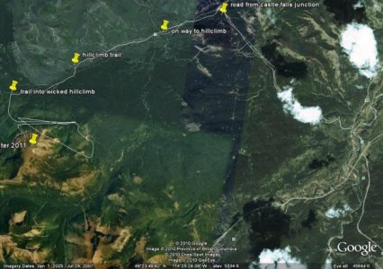
actually there is a trail back there that leads to the backside and base of avion ridge wich would be the back bowl I do believe you are reffering to it looks like on google earth that it would be one hell of a pull to get up to the ridge top then it would be waterton but definately looks severly overgrown according to google earth. i have been trying to find a new way into an amazing hillclimb i reffered to earlier on here that is visible to the west of beavermines lake when you are on the road to castle. we should get a big crew together a few times this year and show each other some of these great spots around castle
I know there's a trail and if you look on google it goes over the ridge. So theoretically you can make it. I don't see it happening. We've also come in from the back of that ridge, and it is overgrown quite bad. Maybe if we get tons of snow....
As for the amazing hillclimb you want to try. We think alike. I've been looking at that for a long time. If it's the one I think you're referring to, it will be bush wacking to get there. There is a road that goes in there, but is washed out on a steep hill, and I haven't found a way around it. Only tried a couple times, so let me know if you get in. Good luck.