Ruby Falls/Southesk Trail

Garryese

Active VIP Member
Joined
Jul 8, 2007
Messages
624
Reaction score
35
Location
Edson, Alberta
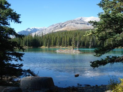
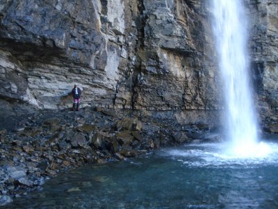
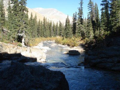
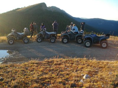
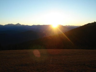
I am taking a group of ATVer into Ruby Falls and the Soutesk On Sept 14 - 16 weekend. The plan is to drive to Grave Flats and set up on Fri Sept 14; Ruby Falls on Sat Sept 15,; and Southesk on Sun Sept 16. If the weather is clear we will go up to Grave Flats Tower on Sat evening for the sunset.

If you want join us, let me know.

Grave flats is about 1.5 - 2 hrs south from Edson.
 

burgewx

Active member
Joined
Jun 7, 2007
Messages
33
Reaction score
13
Location
Cold Lake , Alberta
a couple of boys from bonnyville are looking for something to do that weekend - but thats a long ways to pull a camper and load of quads - anywhere to stay close by - maybe we could join you never been in that area would like to check it out.
would a guy need a 4 x 4 ?
:D
 

Garryese

Active VIP Member
Joined
Jul 8, 2007
Messages
624
Reaction score
35
Location
Edson, Alberta
No 4X4 required, unless it snows 3 feet:D. Paved approx. 70 south of Edson then 20 km of so/so gravel then 50-60km of good gravel roads, last 5 km is unmaintained but decent gravel road.

Closest hotel is in Robb (Bryant Hotel)(60km south of Edson)... I'll give it one star complete with common bathroom down the hall:rolleyes:. Next closest accomadations are in Edson or Hinton. That much driving probably makes loading up the camper worth while.

I do have more detailed driving directions posted on the Alberta Maps section (ATVS) on the left side of the main Snow and Mud page.

These two trails are all about scenery. Bring a camera!
 
J

jmccrack

Guest
Garry

Can a guy get a 36' motorhome in or at least to Cadomon
 

Garryese

Active VIP Member
Joined
Jul 8, 2007
Messages
624
Reaction score
35
Location
Edson, Alberta
No problem to get a motor home to Cadomin. Best to go through Hinton to get to Cadomin.
 

Garryese

Active VIP Member
Joined
Jul 8, 2007
Messages
624
Reaction score
35
Location
Edson, Alberta
Thought I would post some pics from this trip
 

Attachments

  • DSC00751.jpg
    DSC00751.jpg
    75.4 KB · Views: 384
  • DSC00756.jpg
    DSC00756.jpg
    78.4 KB · Views: 379
  • DSC00776.jpg
    DSC00776.jpg
    81.7 KB · Views: 386
  • DSC00780.jpg
    DSC00780.jpg
    74.5 KB · Views: 364
  • DSC00781.jpg
    DSC00781.jpg
    22.5 KB · Views: 365

RatBoy

Member
Joined
Sep 17, 2007
Messages
9
Reaction score
0
Location
Edmonton
They had the gates open to the top of the tower road?
Up there September long and they had them locked up.
When do they open up?
 

Garryese

Active VIP Member
Joined
Jul 8, 2007
Messages
624
Reaction score
35
Location
Edson, Alberta
Not sure which set of gates you mean, but all were open. We went in via the PR road and rode from the confluance of the Ruby and Cardinal.

Foot notes:

1st pic is the Upper Ruby Lake.

2nd pic my best half thinking about the meaning of life behind Ruby Falls

3rd pic is Rudy Creek just after the falls

4th pic is some of the group and machines at Grave Flats Tower. We were there to see one of the best sunsets one can see.

5th pic is the second of five pitures I took of the sunset.

For all but Kim and I, this was the first ride into this area for everyone else.

In the next few days I'll post all the pics of this ride in my album.
 

mudboy

Active VIP Member
Joined
Mar 21, 2007
Messages
560
Reaction score
62
Location
County of Smokey Lake
Your 3rd picture is the classic one. I have the exact same one and when ever someone post a picture of ruby that is usually the one
 

Garryese

Active VIP Member
Joined
Jul 8, 2007
Messages
624
Reaction score
35
Location
Edson, Alberta
Mudboy I have taken that picture once a year for the last ten years to see that change over time. What was nice about this trip is how clear and sunny it was.
 

RatBoy

Member
Joined
Sep 17, 2007
Messages
9
Reaction score
0
Location
Edmonton
Speaking of this area...

Has anyone ever been north of the Toma Creek Trail. On the map it looks like it goes for miles but and it is a little bit of a root on the quad. I just want to know if actual riding areas keep going or if it dead ends over the first hill :mountainClimb:off Cardinal river RD.
 

doo800

Member
Joined
Dec 20, 2006
Messages
16
Reaction score
0
Location
Torrington AB
Those are very nice pictures. I would like to go there the first weekend in October. Is there somebody thats going that I could hook up with to show me where to go or maybe a detailed map how to get there. Thanks and Please
 

doo800

Member
Joined
Dec 20, 2006
Messages
16
Reaction score
0
Location
Torrington AB
I am unable to get the gps cordinates, I don't have the program to support this file Can we use adobe acrobat to bring up the file? Thanks
 

Garryese

Active VIP Member
Joined
Jul 8, 2007
Messages
624
Reaction score
35
Location
Edson, Alberta
Ratboy, some of those trails north of the cardinal river road will hook up with the Mckenzie Creek Trails. But I believe there are seasonal closures in that area.

Doo800, the file can be imported into most gps programs (mapsource, ozi, etc). If you don't have these programs our next option is use the directions to get to the staging area; once there, look for the kiosk on the south side of the cardinal river road. The kiosk has one map and one air photo that shows the lower trail to Ruby Falls. The map shows trails in the lower left corner; one of them is the Southesk Trail (Southesk Trail has a sign at the tail head that you will see when you get there). Or, from staging area, cross the creek, follow the trail until you cross Ruby Creek. From there turn right to go to Ruby Falls, or go straight to get to the Southesk. Or, from the staging area, follow the road west until you see a road on your right, This road takes you up to the Grave Flats Tower (Sunset pictures above). About 100 feet before the tower road a trail takes off from the left side of the cardinal river road; this is the start of the upper (muddy) trail to Ruby Falls. Or, unload at the staging area and start exploring.

When would you be coming through Edson? I could meet you and draw you a map if I am not out tearing up some other part of the planet.

I will be back up there next spring. I'll post it here when I plan that trip.
 

doo800

Member
Joined
Dec 20, 2006
Messages
16
Reaction score
0
Location
Torrington AB
I am not sure if I can go that weekend now. One of my drivers needs to take that weekend so therefore I will have to fill in for him. I guess thats what happens when you are the boss.:(:(:mad::mad: but I may go the next weekend after that. HMMMM maybe with my sled ,who knows there might be snow on the ground:D:D
 

hondo

New member
Joined
Jun 7, 2008
Messages
4
Reaction score
0
Location
edmonton
wow noce pics gary.. i have gone to cadomin for 13yrs in a row now and this will be the 2nd time taking a quad what is the Southesk i have never heard of it but it looks beautiful out there.. we will be going to ruby falls and prob job staging area but i was also wondering about which road the pr or pembina rd is so i can ride from the confluence of the rivers as well.... is that the road to robb??
 

Snowdin

Active VIP Member
Joined
Nov 28, 2007
Messages
946
Reaction score
751
Location
Whitecourt
Looks like an awesome place. Gary can a motor home get into the place where your going to camp?
 

Garryese

Active VIP Member
Joined
Jul 8, 2007
Messages
624
Reaction score
35
Location
Edson, Alberta
Yes a motor home can make it to the camping areas.

PR or Pembina River Road crosses Hwy 40 west of Mercoal. If your traveling from Robb to Cadomin the PR road is about a half kilometer past the railroad track overpass.... not the overpass on the pavement at the 90 degee turn. If you cross the Mcleod River you went too far west. If your coming from Cadomin toward Robb, turn south near the top of the hill after you cross the Mcleod River... gone too far if you cross the train tracks on an overpass.

To confuse things when you turn south onto the PR road you cross the tracks again but on a level crossing.

There is a kiosk at the staging area with maps showing Ruby falls trails and Southesk Trail.
 

Snowdin

Active VIP Member
Joined
Nov 28, 2007
Messages
946
Reaction score
751
Location
Whitecourt
Yes a motor home can make it to the camping areas.

PR or Pembina River Road crosses Hwy 40 west of Mercoal. If your traveling from Robb to Cadomin the PR road is about a half kilometer past the railroad track overpass.... not the overpass on the pavement at the 90 degee turn. If you cross the Mcleod River you went too far west. If your coming from Cadomin toward Robb, turn south near the top of the hill after you cross the Mcleod River... gone too far if you cross the train tracks on an overpass.

To confuse things when you turn south onto the PR road you cross the tracks again but on a level crossing.

There is a kiosk at the staging area with maps showing Ruby falls trails and Southesk Trail.

That's awesome. I'm going to try to make it for that weekend. Will keep you posted.:thumbsup2:
 
Top Bottom