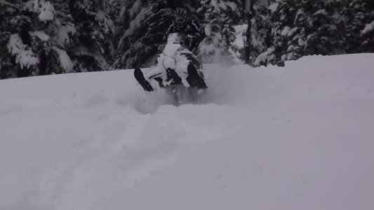
Cataract Creek Snowmobile Area Thread for 2014/15

takethebounce

Active VIP Member
Joined
Dec 10, 2008
Messages
5,193
Reaction score
8,750
Location
calgary
Further South heads towards Crowsnest Pass and Coleman. There is some decent Alberta riding down there when there is snow. In the summer you can drive the 940 all the way. Cut Blocks are well, its a term used for an area that was logged. Typically a moderate sloped area with lots of hazards like stumps remaining depending on snow depth. :)
 

JZ1

Active VIP Member
Joined
Dec 11, 2013
Messages
421
Reaction score
323
Location
Drumheller
Further South heads towards Crowsnest Pass and Coleman. There is some decent Alberta riding down there when there is snow. In the summer you can drive the 940 all the way. Cut Blocks are well, its a term used for an area that was logged. Typically a moderate sloped area with lots of hazards like stumps remaining depending on snow depth. :)

thanks.

so where the trail appears to end on the cataract map does the trail actually continue south?

maybe it's just me but I found the trails to be poorly marked. A lot of what we thought were trails were actually cut lines. Maybe identifying the trails will come with a little more experience in the area
 
Last edited:

JZ1

Active VIP Member
Joined
Dec 11, 2013
Messages
421
Reaction score
323
Location
Drumheller
I created a Google account so I can upload videos to YouTube but when I go to do so it says the video won't publish. Any suggestions?
 

takethebounce

Active VIP Member
Joined
Dec 10, 2008
Messages
5,193
Reaction score
8,750
Location
calgary
thanks.

so where the trail appears to end on the cataract map does the trail actually continue south?


I have never heard of anyone riding all the way down to Crowsnest but at Pasque Mt it becomes the Crowsnest trail system. I don't believe there is one map that shows it all but if you look up the club down there you can view the southern portion of that area.

Cataract is a provincial area maintained by the club where Crowsnest is club ran. The Calgary Club would be a good place to start as well if you like riding the area. They could likely give you more accurate info.

It is almost 100km from the junction of the highwood to Coleman.


Sent from my iPhone using Tapatalk
 
Last edited:

GasCan

Active VIP Member
Joined
Nov 22, 2009
Messages
944
Reaction score
235
Location
North Okotoks Acreage
Website
www.oldgasolinesigns.com
You can take Skyline, Pasque and the Oyster trail south where they meet up and cross the logging road. There are a few trails (or the logging road) that'll take you further south. Usually the snow gets deeper the further back you go and there are some great meadows, a creek and some decent cut blocks to play in back there but you're best to leave the cut blocks alone until there's a good 3 or 4 foot base which is normally January. If you take the logging road about 5-6 clicks south you can peel off to the right and take the trail down to the creek. There's a couple good meadows down there to play in, and from there you can take the creek valley a little further south where there are a few larger meadows off to the west. Good riding with Skyline being the highest point to climb on the way if you take that route, or take the lower valleys or logging road to bypass the trails and get to the south play areas. Just know that Skyline can have some nasty white outs at the top when the wind is howling and can sometimes have 4'/5' foot drifts. Riding down towards the south of the summit can be pretty tricky when there's a fresh dump so keep that in mind as the trail is narrow and gets blown in with drifts. I like the bowls south of the trails. We usually ride the trails south to those spots, and take the logging road back when fuels a bit low or we're tired from a day of riding.

I'm like 45 minutes from the CC area, but have been waiting for some decent snow. Might get out Tuesday or Wednesday of this week with the kids.

gbsnow.jpg
Old picture from the meadows
 
Last edited:

JZ1

Active VIP Member
Joined
Dec 11, 2013
Messages
421
Reaction score
323
Location
Drumheller
You can take Skyline, Pasque and the Oyster trail south where they meet up and cross the logging road. There are a few trails (or the logging road) that'll take you further south. Usually the snow gets deeper the further back you go and there are some great meadows, a creek and some decent cut blocks to play in back there but you're best to leave the cut blocks alone until there's a good 3 or 4 foot base which is normally January. If you take the logging road about 5-6 clicks south you can peel off to the right and take the trail down to the creek. There's a couple good meadows down there to play in, and from there you can take the creek valley a little further south where there are a few larger meadows off to the west. Good riding with Skyline being the highest point to climb on the way if you take that route, or take the lower valleys or logging road to bypass the trails and get to the south play areas. Just know that Skyline can have some nasty white outs at the top when the wind is howling and can sometimes have 4'/5' foot drifts. Riding down towards the south of the summit can be pretty tricky when there's a fresh dump so keep that in mind as the trail is narrow and gets blown in with drifts. I like the bowls south of the trails. We usually ride the trails south to those spots, and take the logging road back when fuels a bit low or we're tired from a day of riding.

I'm like 45 minutes from the CC area, but have been waiting for some decent snow. Might get out Tuesday or Wednesday of this week with the kids.

View attachment 181674
Old picture from the meadows

thx for the advice. Thinking of going back before New Years, maybe I'll see you there
 

retiredpop

Active VIP Member
Joined
Mar 18, 2007
Messages
1,696
Reaction score
5,039
Location
Calgary
For those who don't know - quads are not allowed on the trail system. There was one running around out of Etherington yesterday. You can also see a trail map of the area here although it does not show up to date info as to which trails are impassable.
 

JZ1

Active VIP Member
Joined
Dec 11, 2013
Messages
421
Reaction score
323
Location
Drumheller
Thinking about heading out to CC tomorrow, anyone else want to join? Its the wife and I and we are beginner riders.

Would love to but work has yearly inventory scheduled. Can't believe the scheduled it over the holidays this year, so mad
 

Polar_RMK

Active VIP Member
Joined
May 27, 2013
Messages
291
Reaction score
138
Location
Ontario
Hope cc got some fresh powder today, anyway would be nice to hear the latest snow update from there
 

Quad_hopper

Member
Joined
Feb 11, 2014
Messages
15
Reaction score
2
Location
SW of Calgary
Well, we didn't make it out today to CC. It was too cold for the wife (and me). -19C this morning when we went outside. Looking at the forecast, we are heading out tomorrow (Tuesday). Plan on being at the Cataract staging area around 9 AM. Can't wait to get out and ride.
 

fshog

Member
Joined
Nov 10, 2013
Messages
24
Reaction score
4
Location
Okotoks
Well, we didn't make it out today to CC. It was too cold for the wife (and me). -19C this morning when we went outside. Looking at the forecast, we are heading out tomorrow (Tuesday). Plan on being at the Cataract staging area around 9 AM. Can't wait to get out and ride.

This is Kyle, right? If so, I still have your number and can text you if that works??

Thanks,
John
 

fshog

Member
Joined
Nov 10, 2013
Messages
24
Reaction score
4
Location
Okotoks

Re: Cataract Creek Snowmobile Area Thread for 2014/15
I think the wife and I will try and go out to CC on Wed morning if all goes well.


How does Wednesday work for you Quad_hopper? I see warrentb68 is looking to head out and maybe wants riding company?

 
Top Bottom