
dzignr
Active VIP Member
- Joined
- Mar 18, 2009
- Messages
- 172
- Reaction score
- 103
- Location
- Crowsnest Pass, Alberta Canada
- Website
- www.crowsnow.org
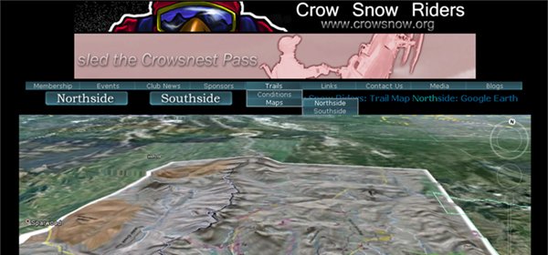
Curious how you sled-heads take to this technology. We have used Google Earth's ability to overlay images, in this case the north and south side trail maps for the Crowsnest Pass trail system. With Google Earth, you can drop down fairly close to the ground and get a feel for the lay-of-the-land in the area. Personally, I would enjoy seeing this technology for all the riding areas! Its great for planning a trip or rehashing where you were that day.
The trail maps get a little fuzzy the closer to ground level you get; I am going to try and get a higher resolution set of images to overlay in future so the loss of fidelity in images is not so noticeable.
Check out the avalanche bulletins below each map as well.
Link to Northside Trail Map:
Link to Southside Trail Map:
If your browser does not have Google Earth installed as a plug-in, you would be prompted to install it. It is well worth it to check out this scenario.
Attachments
Last edited:


