Quadding near Skookumchuck

Wise Mechanical

Active member
Joined
Oct 13, 2008
Messages
75
Reaction score
14
Location
Irricana, AB
Just wondering about quading trails, places to ride near skookumchuck, Girlfreinds family have a cabin that we are heading to in july and would like to do some riding but looking for some insight on where to to ride
Thanks
 

Taminator

Active VIP Member
Joined
Nov 8, 2008
Messages
2,589
Reaction score
1,265
Location
Radium Hot Springs, BC
There's good riding around Invermere and Radium, just depends what kinda ride you're after. Let me know and maybe I can recommend some places. The Whiteswan lake area near Skookumchuck is supposed to be good, there's some park area around the lake but lots of crown land and roads/trails. There's a good atv ride through there somewhere that goes by Whiteswan through to Elkford or Sparwood area, but haven't done it myself.
If you can pick up a Backroad Mapbook Kootenay Rockies edition, that will be your best friend for finding areas to ride. We don't have many dedicated areas you have to find trails and get to areas yourself.

Couple common spots though like the Baddlands and behind Radium on Westside road near the Forster snowmobile area- lots of good rough trail and smooth road, lakes, creeks etc. Just go until you can't go no more!
 

Wise Mechanical

Active member
Joined
Oct 13, 2008
Messages
75
Reaction score
14
Location
Irricana, AB
Good call on the road map, we are heading up there and just looking for anything to ride, we dont really know what to expect, we usually ride cutlines and mud, but really any ride on a quad is still better than being at home working.
 

kjb

Active VIP Member
Joined
Jan 20, 2009
Messages
240
Reaction score
155
Location
a little piece of paradise
Skook lookout is a fun quick ride. Up the Bull river to Quinn creek over an down the Blackfoot, up the North White, over and up the Albert, over and down the Cross, down the Kootenay, back up the White and Lucier, over and down the Wildhorse to Fortsteel. A classic east Kootenay multiday ride. Check it out in the back roads mapbook.
 

quads

New member
Joined
Sep 21, 2007
Messages
3
Reaction score
0
Location
Airdrie
What a Wise has broke the mold and bought something other than a GM product, way to go but sorry it's a Dodge
 

Landrew

Active member
Joined
Jul 13, 2007
Messages
129
Reaction score
8
Location
Edmonton
Last year I payed Toby Creek Adventures $15 to use their parking lot and use my own atv and bike and ride up to an 8500 ft peak looking down on the Panorama Ski hill . This year I want to go again but have heard I can just stage anywhere on that road (for free)from Invermere to Panorama and get onto the same trail and ride. Does anyone have directions to a good staging area to get to the same peaks? Where else is there a good out and back trail to similar heights for varying skill levels close to Invermere?
 

spliff

Member
Joined
Apr 14, 2009
Messages
23
Reaction score
0
Location
mountains
There is a back way in to Paridise mine (toby creek adventures area) it is called the Bruce creek loop. You have to drive through Wilmer and past lake enid. Not sure exactly sure of the mile marker where you unload but it is pretty easy to find! Like so many people have said before pick up a "Backroad Mapbook" for the kootenays. Lots of roads and trails around and that mapbook has most, if not all of them. Bruce creek loop is a little knarly in spots from water running down and wearing out the road but it's not to bad. (just in case you had kids on bikes)
 

Landrew

Active member
Joined
Jul 13, 2007
Messages
129
Reaction score
8
Location
Edmonton
Thanks - I think I will scout that trail 1st with a friend and come back the next day with my wife / kids.
 

Landrew

Active member
Joined
Jul 13, 2007
Messages
129
Reaction score
8
Location
Edmonton
We made it up to the top and down the other side to an old cabin and back up and down again. We took the advice of staging near Toby Creek and entering the trails down the road. It was almost 30C out and no wind. At the peak (8500ft) it was t-shirt weather.

A little Giovanni chinese 110cc quad made it everywhere (but 2 spots where it bogged and got hung up on big rocks)

Thanks for the tips it made for one of the best family days of orr-roading ever!

DSC03577.jpg


DSC03588.jpg


DSC03554.jpg


DSC03550.jpg
 

Landrew

Active member
Joined
Jul 13, 2007
Messages
129
Reaction score
8
Location
Edmonton
No but does this help:

Latitude: 50°29'1.65"N

Longitude: 116°17'49.69"W

This point above is pretty much the peak of the mountain there. You can get to it the short way from Panorama/Toby Creek or longer from the back side (not sure of the details that way) From what I saw of the trails in that area I spent 9 hours at kids speed with many breaks and drove perhaps 10% of what is out there.


Follow the trail on Google earth - go south about 1.3 k then as the crow flies go east 5.3 and google points out Panorama with a Red dot and the word Panorama. The dot is not really the ski hill but is the Toby Creek adventures parking lot. If you park there and use their lot you pay $15 per off road vehicle and can stage form there (gates close at I think 7 though??) or we just parked down a bit and found our way into the trees and away we went.

If you go from that lat/long 4.8km north east you will see a much more defined trail. I believe that is a road and so you could stage anywere there. I believe you have to back track it norht and then east to the tiny town of Wilmer just north of Invermere. We were going to do that and then just drive down the gravel for a while but I wanst sure so we took the Toby Creek / Panorama way in..


I paid the Toby Creek guys in 2008 to do it from there lot and they were very nice about it. If you ask they may give you a map of all the many trails in the area. I just decided to save a few $ and had no time limit to come home by

Here are some more shots of the history in that area:

Bear claws scratching at old log cabin:

DSC03581.jpg


DSC03618.jpg


DSC03612.jpg
 

AB RANGER 007

Active VIP Member
Joined
Aug 1, 2008
Messages
451
Reaction score
201
Location
Vilna, AB,
Thanks this will give me a place to start. I might never get there but I will enjoy the trip on my computer.

Thanks again,Bruce.
 

kootenaycat

Active VIP Member
Joined
Dec 18, 2006
Messages
446
Reaction score
421
Location
West Kootenay
Would you happen to have this trip on a Garmin GPS/ Software.

Bruce.
I've got 3 tracks of that area from our trip over last week. Started at Lake Enid (west of Wilmer) and up Bruce ck over paradise and down to Toby. Also went up Law ck but don't recommend that one for beginners. :D 
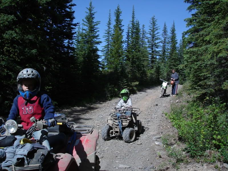
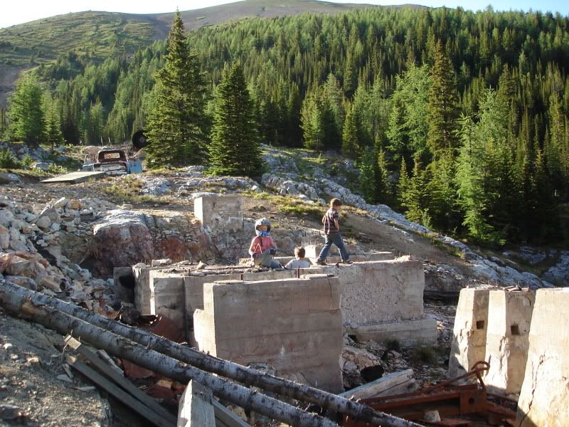
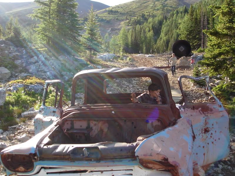
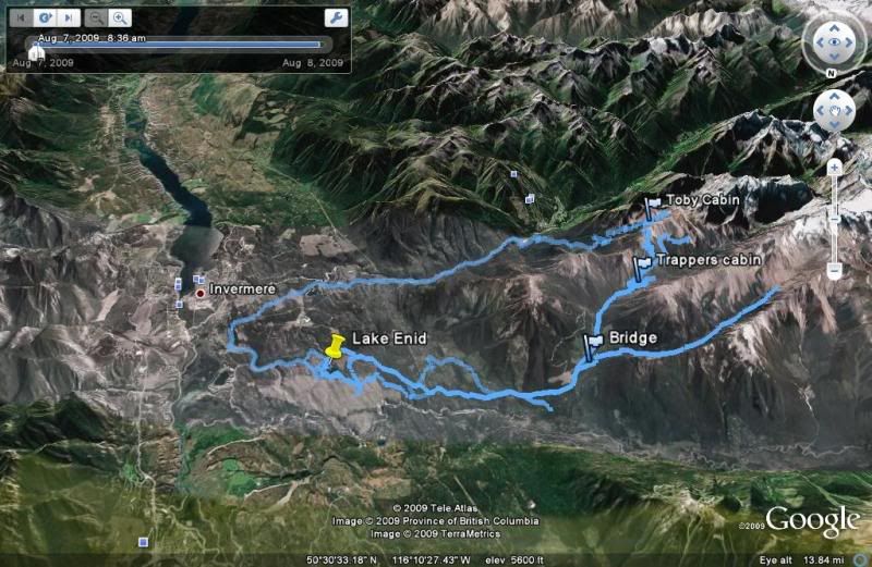
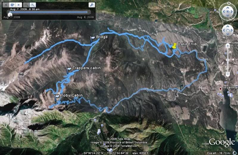
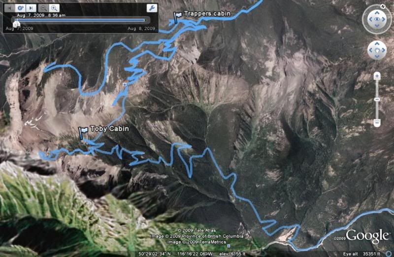
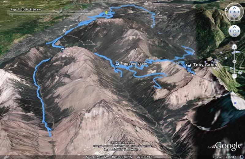
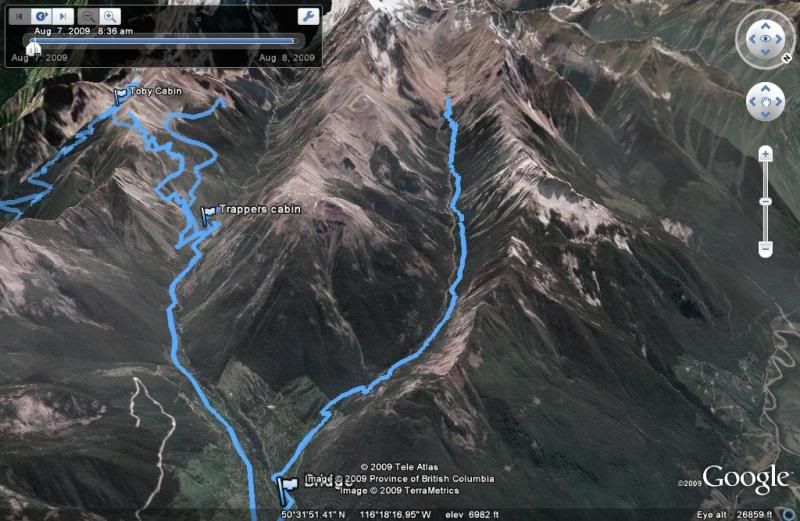
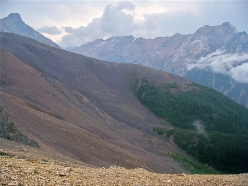
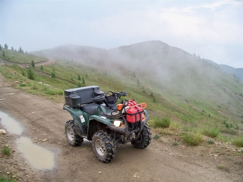
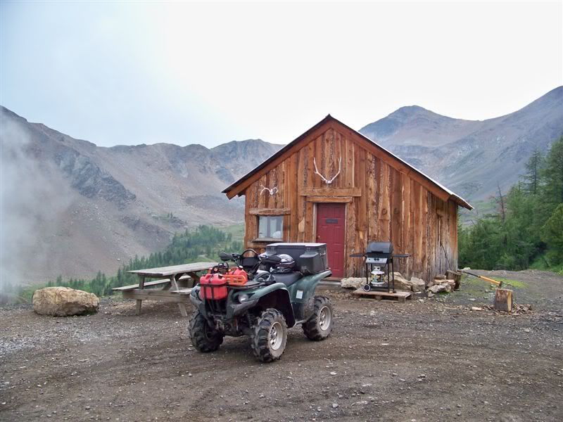
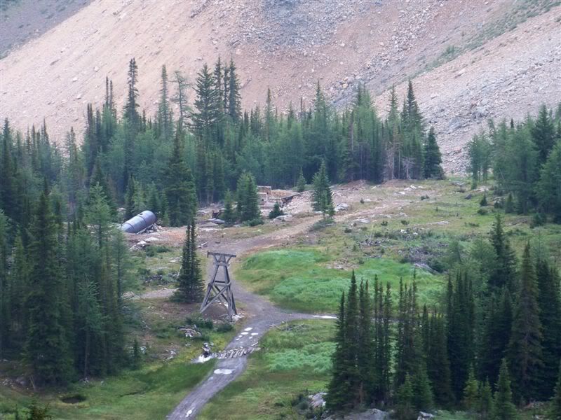
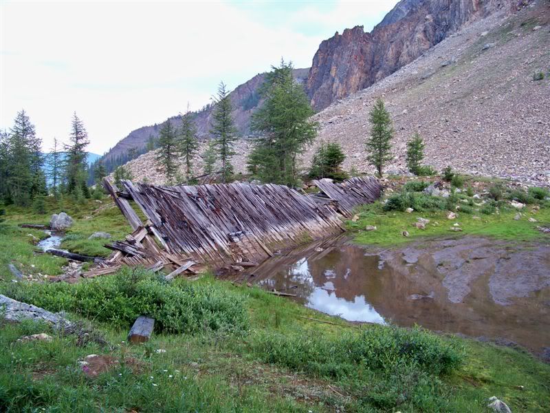
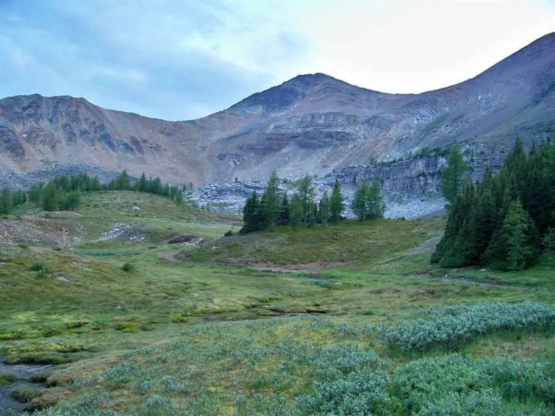
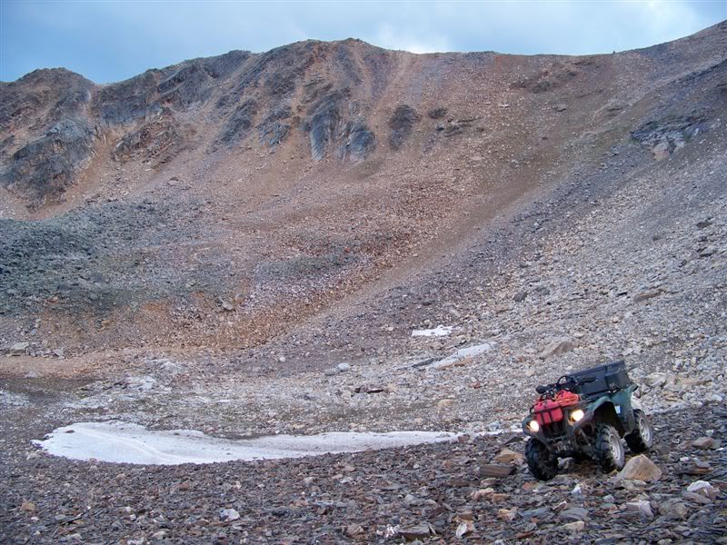
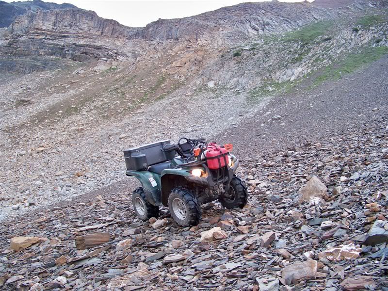
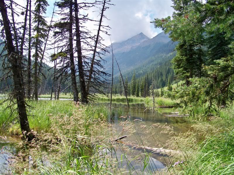
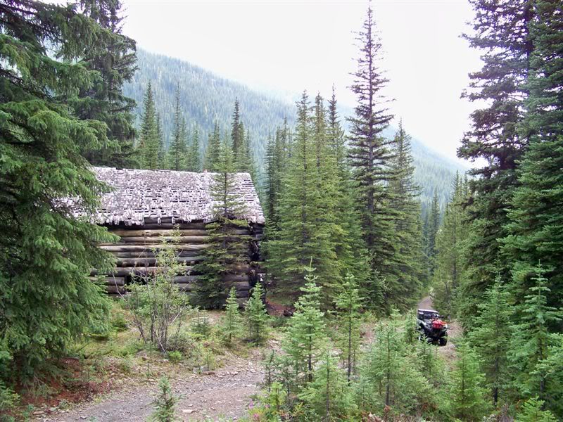
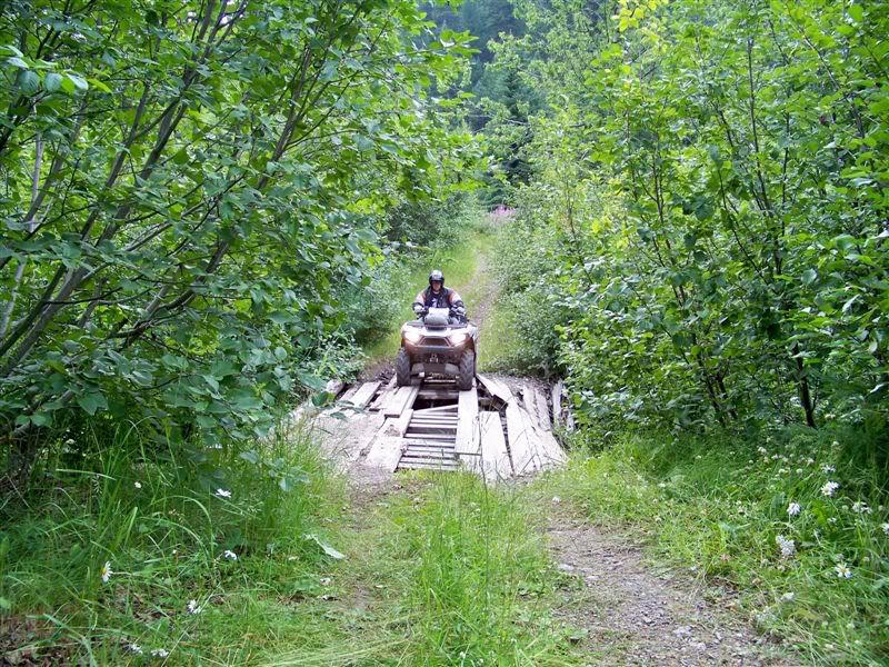
Some sketchy sections that we had to modify by hand just to be able to walk the quads through. Got stopped by a huge rock slide just before the old dump truck otherwise I think we could have gone almost right to the end of the valley.

Kevin

Paradise.jpg


Paradise2.jpg


Paradiseloop.jpg


Paradise3.jpg


Lawck.jpg
 

kootenaycat

Active VIP Member
Joined
Dec 18, 2006
Messages
446
Reaction score
421
Location
West Kootenay
Here's a few pics of our ride to Bruce and Law creeks

The highest point we rode to near Paradise mine, just over 8300'

100_2238.jpg


100_2242.jpg


100_2244.jpg


100_2254.jpg


100_2259.jpg


The cabin at Paradise mine

100_2263.jpg


100_2275.jpg


100_2288.jpg


One of the tram towers

100_2286.jpg
 

kootenaycat

Active VIP Member
Joined
Dec 18, 2006
Messages
446
Reaction score
421
Location
West Kootenay
Used to be a dam it looks like

100_2294.jpg


Meadow in the Paradise bowl, glad to see it was untouched, hope it stays that way.

100_2300.jpg


Playing on the rocks in the bowl

100_2303.jpg


100_2307.jpg


Lake Enid campsite and the lake

100_2318.jpg


100_2361.jpg


Part way up Bruce ck came to this man made pond/swamp. There was a coffer dam where I was parked

100_2332.jpg


Some cool old buildings

100_2349.jpg


Sketchy bridge over Bruce ck on the Law ck trail, not much holding it up anymore. :eek:

100_2371.jpg
 
Top Bottom