How's Tumbler Ridge?

Joined
Apr 26, 2008
Messages
10
Reaction score
0
Location
Peace River
Hey, any of you B.C. boys do any riding in the Tumbler Ridge area? If so, how is it and is it easy to see the different waterfalls in the area? Going to Grande Cache and Tumbler this spring/summer for a week and any info would be a great help. Thanks. Ash
 

dirtdoc

New member
Joined
Dec 13, 2006
Messages
4
Reaction score
0
Location
alberta
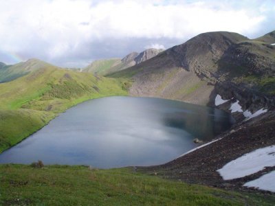
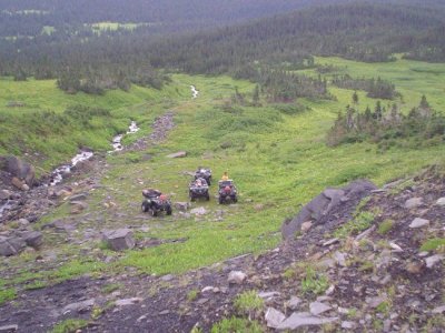
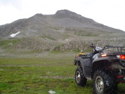
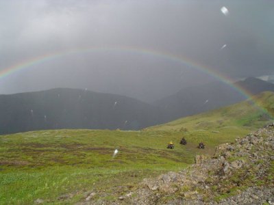
Here are a few pics from Tumbler taken last summer back in the Wolverine.
 

Attachments

  • Tumbler Ridge summer 06 051.jpg
    Tumbler Ridge summer 06 051.jpg
    49 KB · Views: 208
  • Tumbler Ridge summer 06 027.jpg
    Tumbler Ridge summer 06 027.jpg
    82.5 KB · Views: 213
  • Tumbler Ridge summer 06 038.jpg
    Tumbler Ridge summer 06 038.jpg
    51 KB · Views: 195
  • Tumbler Ridge summer 06 047.jpg
    Tumbler Ridge summer 06 047.jpg
    44.9 KB · Views: 193

Allan Wilbee

Member
Joined
May 5, 2009
Messages
7
Reaction score
0
Location
fort mcmurray
The pic are great. I'm from Fort McMurray looking for new places to ride. I snowmobile at Babcock, Bull Moose and Wolverine. Do they have listed trails or are you on your own to explore.
 

mavrick

Active VIP Member
Joined
Sep 18, 2007
Messages
593
Reaction score
25
Location
Yellowknife nwt
can u get in there on dirt bikes as well or to much mud? have seen guys ride in to onion lake on dirt bikes before and that trail is pretty hairy in places
 
Joined
Jun 12, 2010
Messages
6
Reaction score
2
Location
Edmonton
How does one get to the Wolverine area shown above? Does anyone have some information on where the trail-head is? I'm heading up to Onion tonight and I know they are having insane rain there now, so I'm trying to look for some alternates in case there are high creeks/rivers/ridiculously-flooded-muskeg-areas.

Thanks!
 

mavrick

Active VIP Member
Joined
Sep 18, 2007
Messages
593
Reaction score
25
Location
Yellowknife nwt
post if u make it to onion lake i think it might be a little early with the snow we had this year let us know
 

mountainmonster

Active member
Joined
Apr 17, 2008
Messages
56
Reaction score
15
Location
PG
Not to be a bummer but odds are you'd be lucky to make it half way in due to snow, just flew out of pg 3 days ago and you could still sled on the top half of even the smaller mountains in the area. Onion trail has some pretty high elevations and i've tried mid summer in the past and still hit snow on low snow pack years.

Wish i had some info on wolverine, but there is also the red deer falls trail if you continue down the road past the onion, it starts on your right at the bottom of the big long downhill. There is a parking/meadow area at the bottom and the trail starts out the back as an old road.

good luck
 

coastie

New member
Joined
Oct 20, 2010
Messages
2
Reaction score
0
Location
Prince George
trails are listed for the most part.... but you can get pretty much anywhere.
just have to watch the closed trails or non atv trails.....

I don't even see any trails in those pictures. Pretty sure that riding in the alpine rips it up but hey, who am I to judge.
 

Riverjet

Active VIP Member
Joined
Dec 24, 2008
Messages
1,703
Reaction score
1,388
Location
Prince George
Trails gotta start somehow. They just don't appear on their own.

I looked for some smiley's of quads/sleds running over hikers/skiers but didn't find any.:d:beer::smiliestirthepot:
 
Joined
Jun 12, 2010
Messages
6
Reaction score
2
Location
Edmonton
Given the biblical rains that happened over the last week in NE BC we didn't make it to Onion Lake - and good thing too, apparently the highway is washed out in some places.

We followed our Plan B and went to Grande Cache and rode Caw Ridge and Mount Hamell. Awesome riding - I'll post some photos in a day or two.
 

Redbeardy

New member
Joined
Jul 20, 2011
Messages
1
Reaction score
0
Location
Beaverlodge, ab
I'd like to take my Argo and a few quads to onion lake. Can anybody here help me out with directions? How easy is the trail to follow? Is it a pretty well used path or a goat trail?
 

AB RANGER 007

Active VIP Member
Joined
Aug 1, 2008
Messages
451
Reaction score
201
Location
Vilna, AB,
I'd like to take my Argo and a few quads to onion lake. Can anybody here help me out with directions? How easy is the trail to follow? Is it a pretty well used path or a goat trail?

Do you use a Garmin GPS unit and have a MapSource Software program in/on you computer??? If yes, PM me your email address, If no still need your email address to send JPEG'S/Pictures.

Bruce.
 

mountainmonster

Active member
Joined
Apr 17, 2008
Messages
56
Reaction score
15
Location
PG
Coming from beaverlodge, turn left onto highway 52 (i believe), you'll come out just past tumbler, turn left and follow 52 for about 35km and turn right onto the wapiti fsr and follow that until you get to a fork in the road at 24km on the wapiti. About 20m down the right fork you can see the trail shoot off down into the ditch and into the tree's, it's a little grown in now but you can't miss it.

The trail is very well beaten so it's not hard to follow, when you get to the downhill tree'd and swamp section on your decent to the lake you will see trails going everywhere but they all come back to the main trail, years of people finding new ways around bad spots.

good luck and have fun
 
Top Bottom