Large Amount of BC Land Closed to Snowmobilers

skibeadoo

Active VIP Member
Joined
Feb 12, 2008
Messages
293
Reaction score
27
Location
Central AB
It is very difficult to understand these maps. I read maps much of the time and find it difficult to get bearings. There is not very many useable reference points. What does fish and wildlife expect us to do? Are we supposed to input each and every coordinate into my gps which will take quite some time. But even after I do I wont be able to tell if I am to be inside the coords or outside. They need to have it preloaded for download into any gps in order for most/all of us to understand without getting frustrated and thoughing the map in the garbage. I bet fish and wildlife could not even tell you the closures if they sat up on the hill with us with the map in hand. Just my 0.02
 

moyiesledhead

Active VIP Member
Joined
Oct 12, 2008
Messages
5,434
Reaction score
10,775
Location
Moyie B.C.
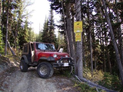
I agree, they're terrible. That's why in our area we're trying very hard to have all areas signed so you don't need to be able to read them. I'm going to forward these responses to the Ministry of Environment here, and hopefully they'll be able to come up with something better. In the meantime, just watch for these......in the East kootenays anyway. Read 'em too, they don't all say you can't go there!
 

Attachments

  • Top-of-Angus.jpg
    Top-of-Angus.jpg
    110.7 KB · Views: 31

zrtdarryl

Active member
Joined
Jan 27, 2009
Messages
46
Reaction score
2
Location
nordegg summers lake havasu winters <retirement p
i personally think that the maps are printed being ambigous as the mapmaker does not really go into the areas to see "natural' borders and also the mapmakers probably go by longitude/latitude. better mapping with good descriptions like the ones in the fishing regs would go a long way .
i have no problem with decent closures as long as it impacts all users equally, in bc heliski gets away with a lot with still being to go into these areas after a flyover and in alberta down by waiparous the hunters get to still use a sled or quad in the afternoon as there is so few going into that area due to the permit regs/draws and only during a short time window , things like this are what really bothers me.
yes i ski and hunt
 

Mongrol

Active VIP Member
Joined
Mar 31, 2007
Messages
593
Reaction score
59
Location
East Shore - Kootenay Lake BC
Personally, I can accept the closures if they apply equally to all users.

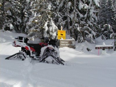
Search YOUTUBE for "Plaid Lake" by Snodin. Shows highmarking in a closed area. - Not a good idea.

Attached pic is signage clearly asking motorized vehicles to stay on road corridors in Plaid Lake area.

We have to police ourselves better and not give opponents ammunition.
 

Attachments

  • P2160010.jpg
    P2160010.jpg
    77.1 KB · Views: 25
Top Bottom