RXN
Active VIP Member
So I seen a post, I think it was on Facebook, talking about the fines for riding in closures.
There was a link to maps to help show these areas.
Here is the link to the maps
http://www.env.gov.bc.ca/fw/wildlife/snowmobile-closures/gpx-download.html
I tried plugging in my Garmin Rhino 700 to try and download these maps to it, no such luck.
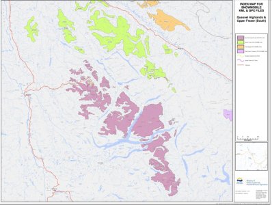
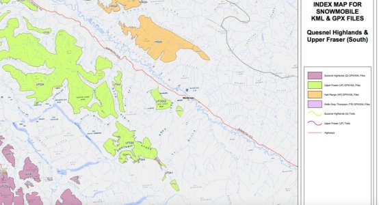
So I figured hey maybe print a map and keep it with me when i ride. How do you read this???
are the colored zones the no ride zones?
There was a link to maps to help show these areas.
Here is the link to the maps
http://www.env.gov.bc.ca/fw/wildlife/snowmobile-closures/gpx-download.html
I tried plugging in my Garmin Rhino 700 to try and download these maps to it, no such luck.
So I figured hey maybe print a map and keep it with me when i ride. How do you read this???
are the colored zones the no ride zones?